| Poster |
 |
|
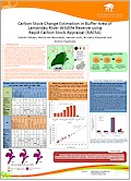
| Title | Carbon Stock Change Estimation in Buffer Area of Lamandau River Wildlife Reserve using Rapid Carbon Stock Appraisal (RACSA) | | Author | Subekti Rahayu, Meine van Noordwijk, Laxman Joshi, Ni'matul Khasanah and Andree Ekadinata | | Year | 2010 | | Publisher | World Agroforestry Centre - ICRAF, SEA Regional Office | | City | Bogor, Indonesia | | Purpose | Science Forum 2010 | | Call Number | PO0234-10 |
|
| Abstract: |
The area between the eastern side of Lamandau river and the western side of Lamandau River Wildlife Reserve (LRWR), Kota Waringin Lama, Central Kalimantan, is considered to be a ‘buffer area’ for the reserve. This area was classified as ‘production forest’ with logging rights assigned to a private forestry company and slated for ‘conversion’ to non-forest uses. Given this ‘planned conversion’ status, reassigning the area to remain under natural forest cover could qualify for support as early REDD (Reducing Emissions from Deforestation and Degradation) implementation action. The logging activity ceased in 2003 and left a pretty much depleted landscape of logged-over forest. Part of the area has peat soils. Quantification of the carbon stock and recovery potential is an essential component of REDD planning for the buffer area. The LRWR is important for orangutan conservation and a buffer zone with wildlife-friendly,
human land use is desirable.
As part of a comprehensive REDD feasibility study, the Rapid Carbon Stock Appraisal (RACSA) method was used to explore the impacts of land-cover change on carbonstorage and to measure the change of carbon stocks over the past 15 years. The objectives this study were to estimate (1) aboveground carbon stock at plot level in representative land-cover classes; (2) belowground carbon stock at plot level, for peat as well as mineral soils; (3) the carbon
emission and sequestration rate of the buffer area and its surrounding landscape (two sub-districts: Arut Selatan and Kota Waringin Lama); and (4) the feasible recovery rate of carbon stocks (under a REDD+ scheme that includes ‘restoration’). Land-cover change was quantified using area-based change analysis and trajectory analysis methods. Information of changes was derived from land-cover maps constructed from satellite imagery from 1990, 2000 and 2005. |
|
|
Download file(s): Click icon to download/open file.
|
| |
File Size |
Description |

|
1,409 KB |
Softcopy |
|
|
GRP 5: Improving the ability of farmers, ecosystems & governments to cope with climate change
|
| Viewed in 2631 times. Downloaded in 532 times. |