| Brief |
 |
|
| Title | Planning for low-emissions development in Merangin district, Jambi province, Indonesia | | Author | Feri Johana and Putra Agung | | Year | 2011 | | Publisher | World Agroforestry Centre - ICRAF, SEA Regional Office | | City of Publication | Bogor, Indonesia | | Series Number | Brief No 19 | | Number of Pages | 6 | | Call Number | PB0037-12 |
|
| Abstract: |
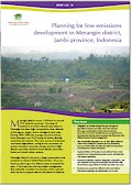
Merangin district covers 7.679 km2 or around 15% of Jambi province1. The level of emissions of carbon dioxide equivalent in Merangin has been high compared to other districts in the region, largely due to changes in land uses. During 2005–2010, the average annual emissions from Merangin was 16.62 tonne of carbon dioxide equivalent per hectare. The main source of emissions was forest degradation, owing to the conversion of primary forests to secondary forests and from highdensity secondary forest to lower-density secondary forest and mixed rubber systems.
Merangin district is home to a large conservation area protected as Kerinci Seblat National Park. Thus, any land-use planning in the district needs to include the park. A land-use plan and associated management that optimally considers the function of the national park can be an opportunity for the district to balance the need for development and the need to maintain environmental functions that help mitigate climate change. |
|
|
Download file(s): Click icon to download/open file.
|
| |
File Size |
Description |

|
709 KB |
Softcopy |
|
|
|
| Viewed in 1991 times. Downloaded in 768 times. |